Kevin Isemonger muses on the southern landscape and some of its recent human history. For the GPS-equipped, he includes latitude and longitude references for key locations.
Those were different times: on 14 August 1862 Horatio Hartley and Christopher Reilly walked into the assay office in Dunedin with 40kg of gold they panned where the Kawarau River from Wakatipu meets the Mata-Au (AKA Molyneux or Clutha) River from Wanaka and Hawea at a place called Cromwell.
This find triggered the ‘Dunstan Rush’ and central Otago changed for ever.
The California gold rush started in 1848 and the Australian rush in 1851. Gold fever spread quickly around the world. Gabriel Read’s discovery near Lawrence on 25 May 1861 paled into insignificance when tales of shovelling nuggets off beaches in the Arrow River sparked a stampede to one of the most isolated, bleak and barren parts of New Zealand.
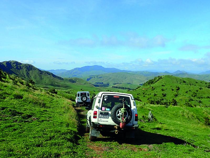
There were two common routes into the interior – the Pigroot following the Shag River inland from Palmerston (just north of Dunedin) to Kyeburn – and from the south following the Oreti or Mataura Rivers from Invercargill. The southern route stopped at Kingston on the southern shores of Lake Wakatipu with sheer cliffs dropping into the depths, but with gold fever in the air, “We haven’t got time for the scenic route, we’ll cut straight across”!
It’s hard to believe these days but with huge numbers of miners now arriving from the Australian and Californian gold fields and many becoming lost and dying in the inhospitable wilderness, a more direct road had to be surveyed to reduce the death toll.
The Maniototo in Central Otago is an area made up of ‘horst’ or block sections of the earth’s crust that have been thrust up leaving adjacent sections on either side (graben) at a lower level. Many of the valley areas between Dunedin and Wakatipu were near impenetrable due to the matagouri and spear-grass that surround vast swamps formed in the grabens.
The easiest route with pack horses involved following the higher ground. This was also the most dangerous due to the altitude producing rapid and extreme changes to the weather. Strong winds explode out of the southern oceans collecting stones and dirt, sandblasting the tops off the exposed north-south horst, carving away the softer rock and dirt, leaving the much harder rock standing as tall, black sentinels defying the elements.
This direct route from Dunedin became known as the Dunstan Road. Starting from only a few metres above sea level at Outram, SH87 rapidly gains more than 400m in elevation in just 8km, peaking at 550m near the pub at the Clarks Junction turn-off, marking the start of the ‘Old Dunstan Road’.
Up here the air is clearer. The horizon holds the sentinel wall of the Old Man Range and Garvie Mountains – and before you, are the rolling down-lands of Central Otago. In the 1860s the view would have been hills blanketed in matagouri. Now, the view is green pasture. Sheep are still the dominant species and there are massive expanses of barley, wheat and corn.
The turnoff to the Old Dunstan Road is right next to the Clarks Junction Pub (-45.726108, 170.047523). The original hotel on this site was the end of the first day by stage coach from Dunedin. The first part of the Dunstan is well formed and well farmed with sheep, beef and crops but the terrain slowly changes to a scorched earth appearance as you approach the Lammermoor and climb up the side of the southern end of the aptly named ‘Rock and Pillar’ Range. It is not practical for run-holders whose property the Road passes through to fence either side – so ‘child-labour’ is handy to open the many gates along the road.
Here, tall pillars are scattered across the slopes of the Rock and Pillar Range.
“After three days in the desert fun I was looking at a river bed.”
(Bunnell Dewey – America)
Striking north up the eastern side of the Loganburn Reservoir (formally ‘The Great Moss Swamp’) and crossing the Loganburn Causeway we approach 1,000m in altitude. This is a whole different world. In the summer the blast furnace wind rips across this barren land where no trees grow. Deformed rock tors dot a landscape that Peter Jackson used for Rohan, the Kingdom of the Rohirrim.
‘Abandon all hope – as hope has forsaken these lands’ – as I drive I am picturing miners plodding along this road, loaded down with their worldly belongings and tools clanking.
Behind, the road just stretches off into the distance – a yellow ribbon draped across the undulating landscape interrupted by the blue of Loganburn. Perhaps the distant cloud is the coast – or perhaps a storm.
This region was to have been the location for a two billion dollar wind-farm to be built by Meridian Energy in 2007 with the installation of 176 wind-turbines. I cannot imagine what that would have looked like had it gone ahead.
We cross stream after stream with concrete bases on the way to the highest point at just over 1,000m, heading down to the thin outlet point where the great Serpentine Swamp becomes the Taieri River and heads north around the Rock and Pillar Range and down to Outram through the Taieri Gorge.
The Dunstan Road joins the Upper Taieri-Paerau Road next to the old settlement of Styx.
One of the few buildings remaining is the Styx Jail and one of the old hotels (-45.419235, 169.945719). Originally there were two, one on each side of the river – in case it was in flood. This was the end of day two on the stage coach from Dunedin, and there is a story about a chap who overslept in the hotel and was roused at the last minute. He reached across to grab his false teeth which were soaking in a glass of water over night, but the water had frozen solid, so he placed his ice-bound teeth in his pocket and ran for the coach.
The ’Old Dunstan Road’ officially heads up ‘Paerau Road’ to turn left into ‘Linnburn Runs Road’ before rejoining the Dunstan again. I am not convinced that this section is part of the original trail, as there is a straighter 4WD track marked on the topo-map, but it appears all locked up on private land.
We pick up the track again off Linnburn Runs Road (-45.350109, 169.900051) where there is a gate and notice advising of road closure from the first Tuesday in June to 30 September each year. Not dissimilar to the rules in the Australian Outback after the rains, these roads also turn into slimy, boggy tracks in the rain and mud tyres cause substantial damage, hence the closure. Track damage can lead to track closures so common sense is needed here.
The 18km stretch from Paerau to Poolburn is an awesome road for mountain bikes and gravel touring bikes.
This is an absolute desolate area. Wide empty plains between rough, rocky hills that stretch in all directions. Fire was used to clear the Matagouri and some effort has gone into removing the giant spear-grass or ‘Wild Spaniard’ which is a particularly nasty item you do not want to bump into. Rosehip bushes were deliberately seeded here to reduce the instance of scurvy, a diseased caused by the lack of Vitamin C. The Serpentine Church (-45.406376, 169.718040) is well worth a visit. The topo-map shows Serpentine Road coming off Linnburn Runs Road a few km past the Dunstan turnoff – but I have not driven that track. We went in via Long Valley Ridge Road, which is about 2/3rds of the way to the Poolburn from the Paerau end. We did it by ourselves – and would have liked to explore the Serpentine diggings more, but I have to admit to being a little on edge with children on board as the weather started to pack up and sleet started to blow. We headed south to pop out on ‘Deep Creek Road’ and the track was quite ‘challenging’ in places. When it gets like this Dad must stay cheery if ‘Driver-Assist’ in the passenger seat is doing that ‘corner of the eye’ thing.
“After nine days, I let the horse run free ‘Cause the desert had turned to sea.” (Bunnell Dewey – America)
The Poolburn Reservoir was built during the Depression years between 1929 to 1931 as an irrigation source for farmers in the Ida Valley. It has a large curved concrete dam and the lake formed by the dam drowned the third night’s accommodation for the Stagecoaches at one of the five Poolburn hotels.
Leaving the Poolburn we come over the rise and are quite surprised at the elevation, 400m above the Ida Valley below. The view is truly magnificent with Rough Ridge to the right and the Raggedy Range straight ahead stretching north to the Hawkduns. The difference the Poolburn Dam has made to the valley is obvious – made more so from satellite imagery revealing kilometre-wide crop irrigators forming green patchwork circles across the valley.
The road is about the same grade as we descend into the Ida Valley where the Dunstan Road emerges at Moa Flat. Where the old Dunstan Road goes from here is a bit of a guess, as all maps and guides show Moa Flat as the end – but we are not at any gold fields in Moa Flat
Turning left into Aston Road takes us to Upper Manorburn Road, which again is a nice easy drive and is near identical to the Poolburn in appearance. The road is closed in the winter months. I tried to get up to the Poolburn a couple of years ago on a stunningly clear day in August, only to get the 4WD rental car ‘geotechnically embarrassed’ halfway up the hill.
To continue our journey west from the end of the Old Dunstan Road, depends on where we want to go. Heading to Alexandra: from the Upper Manorburn and Aston Road intersection, turn right into Poolburn-Moa Creek Road and left into Crawford Hills Road. Take the time at the top of Crawford Hills to admire the view and inspect the old mining water races used for the Sluice Guns in days gone by – now used for irrigating a drought prone valley below. On the western side of Crawfords Hill check out the schist stone retaining walls holding up the old road.
My guess would be that the Dunstan Road would have gone up the Ida Valley-Omakau Road off Poolburn-Moa Creek Road and climbed up and over the Raggedy Range. Stop near the top to admire the great views north up the Ida Valley and appreciate your progress from the Lammermoors to the south. Over the other side stop again for views north up the Manuherikia valley to the distant Hawkdun Range and straight ahead is the mighty Dunstan Range.
At the bottom of the hill turn left by the Ophir pub and drive south through the main street for a photo outside the Ophir Post Office and the Ophir suspension bridge. Built in 1879, the suspension bridge has two schist masonry support towers that hold its cables.
Out of Ophir Bridge Road, turn right onto SH85 into Omakau, turn left up Harvey Street at the north end of town and continue straight onto Racecourse Road. Continuing for 10km on Racecourse Road brings you to the start of Thomsons Gorge Road.
Thomsons Gorge was the main route through the Dunstan Range and was taken by William Rees to bring 1,500 sheep through to his new ‘run’ on the shores of Lake Wakatipu in the summer of 1860. I am told it is very popular with mountain bikers – but I think my knees would explode before I got to the top of the first climb. This is a gruelling 450m climb in about five km but the views back down the valley while you put up your Oxygen tent are breathtaking. Below is the fertile and heavily farmed Manuherikia Valley with the brown form of the Raggedy Range behind and the horizon is the Rock and Pillar Range holding the coastal cloud back from entering the Maniototo basin.
A bit of a late arrival is a musterers hut built in 1908 (-44.970879, 169.482111). This is a great place for a lunch stop next to the stream – but no shade on a hot day, and in the bowl of the valley, not a breath of wind. From the hut it’s a steady climb of about 150m over 1.5km to reach Thomson’s Saddle.
The road is an easy drive down on the Dunstan valley side rewarding elevated views over the Bendigo – Tarras valley towards the Pisa Range and north to the back of Mount Grandview behind Lake Hawea with a glimpse of the Southern Alps.
At the end of Thomson Gorge Road, turn left onto Matilda Rise and left into the Blue Mines Road by the ‘Folding Hills Winery’ to head up to the ghost town of Welshtown. We have been coming here for years and it is staggering the changes in the area. Our first visit back in 1988 we had trouble finding the old ruins off a rough 4WD track up into the matagouri covered slopes. Open shafts dotted the hillside with a few waratahs and barbed wire ‘safety fences’. We were tripping over the rabbits which had chewed off everything – with piles of black glass stacked up outside rabbit burrows where they had mined out an old rubbish tip.
It was pleasing to see on a recent visit that the old houses at Welshtown were still the same after over 30 years – but the road had certainly been improved.
Back down the hill and follow SH8 to where it all began – Cromwell. The memorial to prospectors Horatio Hartley and Christopher Reilly is on the right. The Cromwell Heritage Precinct is a great spot for lunch. The buildings were perched high on the ridge above the Kawarau river below before the Clyde dam flooded the valley forming Lake Dunstan.
The environment in this region is fragile. The ground is hard as rock in the summer but becomes total slop in the winter and worse if you add snow. The number of lives lost in the area in the pursuit of gold is truly immeasurable simply because many of the miners were drifters, off to seek their fortune – and never heard from again. The ones that made it either went back to their country of origin, or stayed on to be buried in some of the beautiful cemeteries that dot the landscape in the most unlikely of places – begging the question “I wonder what was here”.
Nothing on earth beats a Maniototo sunset in autumn, so make it a bucket list item – and please tread lightly.