
Paul Richards gets out for a look at some classic winter scenery
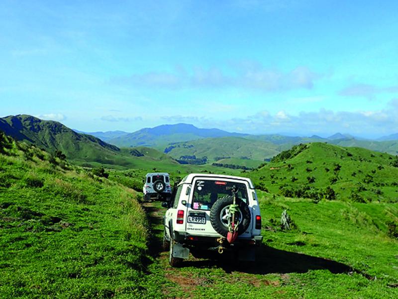
Rangitata Gorge Road
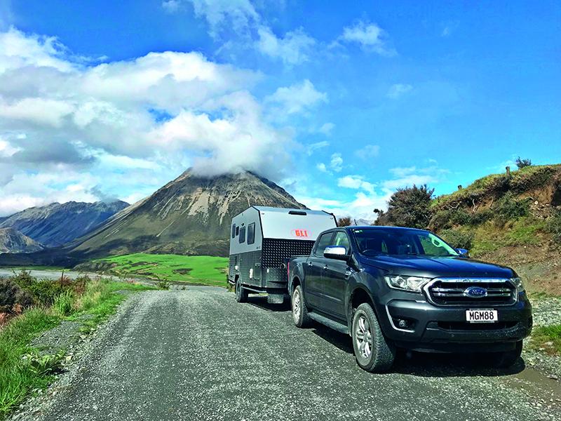
As I write this (mid August), South Canterbury has just survived heavy and prolonged rain and a couple of heavy snow falls. Up at the ski-fields they are talking of a two-metre base of snow and are looking forward to a good ski season. Here in Geraldine, we are at 190m above sea level so just caught the fringe of the snow storms as they went through with just snow flurries, not enough to settle. We did get quite a bit of rain though, our normal monthly rainfall in 36 hours, which caused the rivers to flood and a lot of surface water across paddocks and roads. This came at the worst time for our daughter and family, their farm is at 290m and they are right in the middle of calving on a 1300 cow farm, mud up to their knees and cold biting wind. Whilst they got about 10cm snow, it didn’t stay long fortunately as fresh calves don’t have a great survival rate in the mud, rain and cold unless you can get to them quickly. This means going round the herd often, meaning early starts and late finishes. Raewyn and I have been doing the rugby, netball and ballet runs into Ashburton with our grandkids so the good old BT-50 has earned it’s keep trucking along muddy gravel back country roads almost on a daily basis lately. One of the many reasons I own a 4WD.
Today (14th August) was the third fine day in a row, -2.9°C at 8am climbing to a warm 10°C by lunchtime, so I decided to head up the Rangitata Gorge Road towards Mesopotamia Station to see how much snow had remained on the Two Thumbs Range and Four Peaks Range behind Geraldine. They had obviously had a lot of rain up in these ranges as all the creeks and flood courses were washed out and shingle banked up where the local road maintenance crews had cleared culverts and fords.
Rangitata Gorge Road is an easy drive which you can do in a car if you are comfortable on gravel. I prefer a good 4WD as the road can get a bit cut up at times and there are several concrete based fords to cross.
This is a road I like to take family and friends who are passing through Geraldine and would like to see some great scenery. A friend who has toured through Europe and particularly Switzerland reckons this trip up to Mesopotamia and the one up to Lake Heron would rival any scenery he has seen over in Europe.
I usually take a thermos and have a brew off the tailgate at Forest Creek for morning tea, then carry on up to Mesopotamia Station and go out to the Rangitata River bank for lunch if I have guests, cooking bacon on the camp cooker on the tailgate for bacon sarnies. However, this trip I turned back at Forest Creek and was home to Geraldine for lunch and to watch the delayed coverage of the second All Blacks vs South Africa test.
To give you some perspective of how quickly we can get up into the hills from Geraldine, here are some milages.
At 23km on the odo from Geraldine you arrive at Peel Forest village. There are some great walks through the ancient forest here including to the 1000-year-old tree, Ackland Falls, and the tracks up to Little Mount Peel and further to Mount Peel.
At 29km is the old Anglican Church on Mount Peel Station, owned by the Auckland family, and with Dame Ngio Marsh buried in the cemetery there. From here you now are into the scenic stuff, with Little Mount Peel and the ridge up to Mount Peel parallel to the road.
At 34km is Waikari Road which takes you to the home base of Rangitata Rafts who take rafting trips through the Rangitata Gorge. This is a great trip if you are into adventurous stuff. At the top of the hill above here you get onto the gravel.
At 44km is Coal Hill. There are hiking tracks from the road here up to the tops if you into tramping. This is where Mr Rooney (of Rooney Earthmoving) has built a big hunting lodge. When it was all go, guests would fly into Christchurch, chopper out to the lodge, then go hunting for trophy animals in the ranges behind this area.
At 45km is White Rock Station and the lookout down into the Rangitata River above the Rangitata Gorge. This is where I like to stop and take in the view up the valley right through to Mesopotamia Station and the Southern Alps in the distance, Ben McLeod Range on the left and Harper Range and Mount Harper on the right.
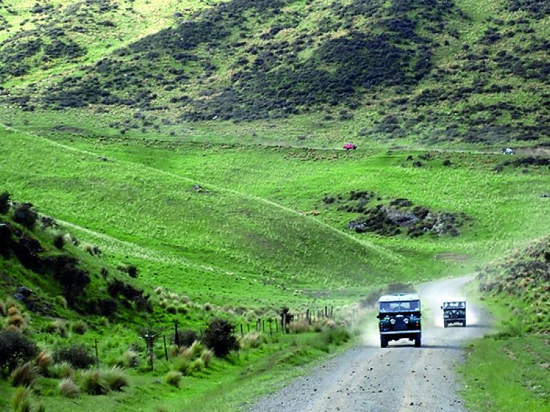
From here you travel up the floor of the valley past Stew Point Station (at 51km) and Rata Peaks Station (at 54km). There are several creek crossings and fords in this area from the lookout up to Rata Peaks which all showed signs of flooding and lots of swept down shingle. The fords all have concrete bases.
The land rises very steeply from the road and you can pick out several water falls coursing down from the plateaus up on the top.
It is also very scrubby through this area and there are a lot of deer and goats running through here if you take the time to look. I’m not sure if these are wild or are part of the stock from these stations. Using the full zoom of my camera (Canon SX40 which goes up to x40 magnification) I managed to pick out some Tahr on this trip.
Next up is Ben McLeod Station at 59km. From here you can look across the Rangitata River through to Mesopotamia Station in the far distance.
They have recently built a new fire station here to house a 4WD fire truck as it is a long way to bring a fire truck in from Geraldine or Peel Forest in an emergency.
You pass through the station homestead and past the old woolshed and yards. Sheep here are merino and I was fortunate to see a flock of rams heading out from the yards and over a small hill with the alps behind them.
The country opens out from here into the Forest Creek flats. You arrive at the Forest Creek bridge at 64km. This is a wooden bridge across a wide flood bed. When in flood, the normally minimal creek will be flood bank to flood bank bringing a huge amount of shingle down with it. It seems to be a constant battle to keep the bridge clear with big piles of shingle beside the area I normally stop in for morning tea. Today it was iced over mud puddles so I didn’t go too far into the area by the bridge.
Carrying on up the road, the next station in Forest Creek Station and at the end of the road about 10km from the bridge is Mesopotamia Station.
This is a great half day or full day trip from Geraldine and well worth incorporating into your trip if you are passing through from Christchurch to Wanaka/Queenstown. It will take you into some truly stunning scenery which you would not normally see.