The Kauri Coast 4WD Safari is a classic on NZ’s tag-along calendar. Ashley Lucas reports from this year’s Pre-Lockdown event.
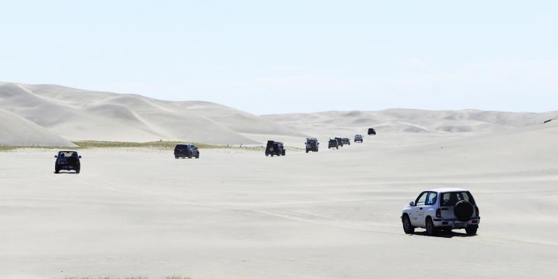
The sun was beating down and all that could be seen in any direction was sand and sand dunes and I began to think this was what it would be like driving through the Sahara Desert. However, we were much closer to home, at Pouto in Northland on the second day of the Kauri Coast 4WD Safari making our way through the dunes.
The Kauri Coast 4WD Safari is organised by the Kauri Coast 4WD Club and raises funds for the Northland Rescue Helicopter and this year there were a little over 60 vehicles in attendance. The base camp this time was at the Kauri Coast Holiday Park with camping down beside the confluence of the Waima and Kaihu Rivers. Camping here gave a range of amenities including BBQs and kitchenettes for cooking, along with ‘proper’ toilets and showers rather than the usual portaloos and the basic camping fee was included in the entry fee. Cabins etc were also available for those who wanted to upgrade their accommodation at additional cost and given that they were fully booked out, seems that many did.
Compulsory stop
Most arrived the Friday to get registered and settled in ready for the early morning start which commenced with the all-important briefing by Ron McCloy before lining up ready to leave. First up was a drive around the back roads through Donnellys Crossing before heading north on SH12 through the Waipoua Forest towards Waimamaku before turning off the road onto farm land. Here we regrouped and due to the long hot summer and drought conditions, fitted the compulsory spark arrestors.
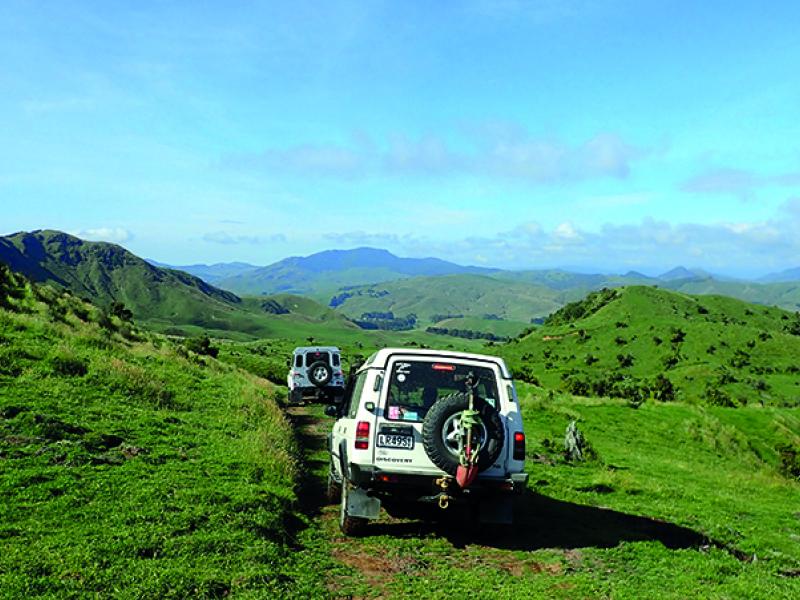
We twisted and turned our way through the farm land with Ron McCloy leading and relieving his wife Chrissy of her bras to mark the gates which needed to be closed. The Kauri Coast events have become well known for the use of bras and knickers on the gates and they certainly are visual markers that can’t be missed.
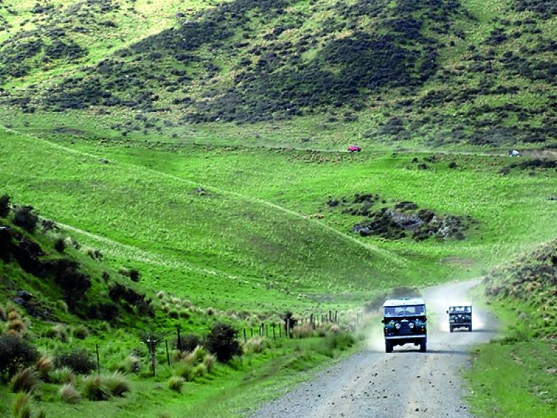
Soon we were crossing the Waimamaku River, picking our way through the boulders and out to Wekaweka Road for a short drive before entering a forest block. The forest had recently been harvested in this area and at the top of the road there was a tricky entrance onto a track.
For the Bishops in their Isuzu D-Max they lost traction when the front wheel lifted and on backing up for another attempt the tow bar dug in and unearthed a large rock. With the tow bar removed the rock was cleared and we were all moving again into the bush.
There was another tricky spot with exposed tree roots and a hard left turn and a vehicle with winch was positioned to winch up the few that couldn’t make it after 2-3 attempts like Bruce Stockwell in the Mitsubishi Pajero.
Back out onto farm land there were a couple of options for those who wanted a challenge and those who wanted the easier option with about 50/50 taking each option and meeting up again a few hundred metres further up the track.
Au naturel!
Lunch stop was on the airstrip on Ron and Chrissy’s farm with views over Waimamaku and even through the hills to the Tasman Sea. After lunch there was more twisting and turning around the farm until we got to the ‘nudist camp’ where it was suggested we all had to conform to the ‘dress code’ – but most were more interested in the big zigzag hill on the other side of the little creek.
In the past it was tricky enough coming down due to ground conditions, but this year it was very dry and we were going up or take the alternative less challenging option. Because of the very dry conditions most made it without any difficulty although someone who shall remain anonymous struggled on the first rutted bit until it was suggested he engage his centre diff to be in 4WD, but still had to be towed up that section.
What a G.A.S
After completing what turned out to be a large loop, we eventually arrived back at another crossing of the Waimamaku River and climbing back up to the main road. From here it was either to Waimamaku to fill up, Pakia Hill and the view of the Hokianga Harbour entrance or return to camp. The G.A.S Service station at Waimamaku proved very popular for filling the tanks and the staff were even on hand to assist with pumping up the tyres as well.
That evening there was a gathering for the multiple drawing of the raffle tickets which had many sponsored prizes up for grabs. First ticket drawn got first choice of the prizes which included a pair of GME handheld radios in a case supplied by ARB Northern – Union Car Spares of Whangarei.
Sunday was again an early start as we needed to get all the way down Ripiro Beach before the tide came in but first we took Aranga Station Road which is a little-used unsealed road that, for much of its length, has been built on the former Donnellys Crossing Railway and runs beside the Waima River. Arriving at the beach entrance at Maunganui Bluff, those that hadn’t dropped the tyre pressures for the long beach drive to Pouto lighthouse did so before heading down the beach.
Long Drive!
Ripiro Beach, to use its correct name, is 107kms long, making it New Zealand’s longest driveable beach; being longer than the more famous 90 Mile Beach at North Cape which is only 88kms long. The beach is backed by high, golden sand dunes and is the site of many shipwrecks, including a French Man O’ War and what is claimed to be an ancient Portuguese Caravel, especially towards the southern end.
The beach is a gazetted highway and the standard rules of the road apply and best to drive along its hard sands two hours either side of low tide.
Pouto Lighthouse
It was a steady drive down the beach passing the various coastal villages such as Omamari, Bayleys Beach, Mahuta Gap and Glinks Gully to the Pouto Lighthouse. On regrouping the tyre pressures were dropped further as we prepared to head inland and skirt around the dunes to come up behind the lighthouse. Once up there you could see South Head on the other side of the Kaipara Harbour and to the horizon out to sea and back north.
There was a smallish sand dune to get up to the flats on top and several vehicles became bulldozers in an effort to shift the sand in their attempts to get up. Others made it look all too easy but it showed that there is definitely a technique and skill in driving soft sand.
We had lunch there and were able to walk down to the lighthouse which was built in 1884 and is one of the few remaining wooden lighthouses in New Zealand. Due to the sand erosion vehicles are no longer allowed near the lighthouse or on the dunes leading up to it and the door is boarded up so we can no longer go inside.
The lighthouse is all that remains of a much larger complex which included two houses for the permanent lighthouse keepers and their families as well as a signal station and other buildings.
Parting of the ways
After lunch there was a split of sorts, which confused things somewhat. A group were going to beat the tide and head out early by going south around to Pouto Point and take the inland road back to Dargaville. The rest would leave in a couple of groups and make their way north around and through the dunes before entering the beach again when the tide was going out again.
It was not easy going following small existing tracks in and out of small brush and ti tree and coastal marram grass, with a couple of hold ups to assist vehicles that got into a spot of bother. In fact, driving through these dunes it is so easy to lose your sense of direction as there are no real landmarks to help navigation. No wonder so many ships became wrecked in the area.
Just as well for us that we had a leader who had local knowledge that was able to get us through these shifting-type sand dunes.
When safe to do so we exited back onto the beach for the final run to Glinks Gully to pump up tyres and make our way home again. The Kauri Coast Club delivered yet again a fantastic weekend and each day was a totally different experience over completely different terrain. Something that can only be done in the far north of New Zealand.


