The Motu Safari was back on the calendar this summer with the same mix of stunning East Coast tracks and trails but a new simplified three-day format. Murray Taylor has the story.
In the past ‘the Motu’ has been a true safari – pack your camp and carry it with you. This year though there was a major change to that format, vis-a-vis a permanent campsite for the duration. That’s right. No more rush to pack it all, even if wet, this year it was just breakfast and tidy up, pack lunch and check the truck before departing camp.
The campsite is still in the paddocks opposite the (Motu) school, with plenty of space to spread out. I arrived early-ish (though I was not the first) and got to pick a spot alongside a pair of pear trees.
There was quite a drop in temperature (which was most welcome, mind) on my first night camping ‘on site’ and I was awoken early by the sound of quad bikes and dogs barking as the shepherds started work.
Next to arrive was a stock truck to take a load away from the yards just up the road from the school, so believe me, I felt quite at home! As if that wasn’t enough a top dressing plane flew in low checking out the air strip up the valley before disappearing. Busy places these remote little spots, obviously.
Of course, these days the greater Motu area is playing host to more and more visitors keen to soak up the huge history relating to the early days, of bringing in the country for farming, while actively enjoying the Motu Mountain Bike Trail, or just the old Motu road (by 4WD, car, trail or even push bike).
Cool change
There’s still a bit of activity about camp as I turn in for the night, with the anticipation of an early start in the morning. Come Saturday, though, and brrrr, you’d think it was winter, with a very cold wind blowing down the valley and a shower or two of rain in the air.
Breakfast is underway in no time as the camp comes to life – the day’s plan being registration and line-up the trucks for safety checks from 8.30am all depending your group/s given start time in the email instructions.
It’s traditional on the Motu Safari to follow the arrows and read the information booklet as you proceed on and through the different stations.
And so, once on the move it was a left, left, left and right as we toured around Motu to head down the road to the Motu Falls, not to be visited this morning, but well worth the effort if you are plotting a trip of your own to the area.
Waitangirua Station (IFL) is the first we enter, now travelling on gravel which turns into a farm track as the first gate of many is approached, the lead truck opens then proceeds through the gate to park, closing the gate after the last vehicle in the group to become Tail End Charlie, (of our little group).
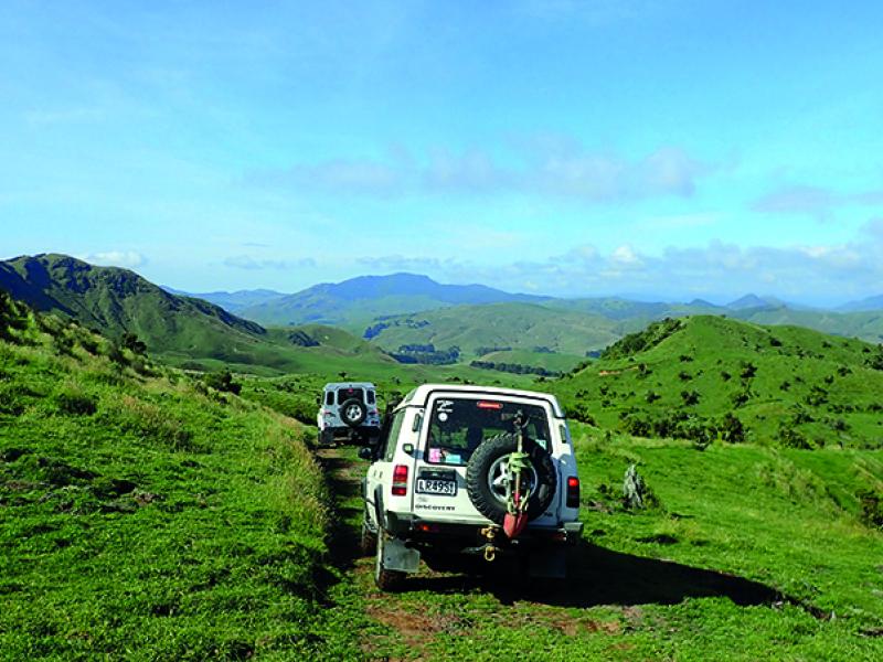
This means that all, at different times of the day, rotate through our little convoy from rear to front depending on the number of gates encountered. We climb towards to the clouds and a distant saddle on the ridge at the head of the valley. The climb commenced at 500m and it’s sometime before we pass over the saddle at 800m to commence a slow downhill descent through open farm land.
Its downhill but not all that steep before arriving in a stream bed, which we follow downstream for a short distance, before another hill climb; this one through heavy grass for the first section, then bush before the last muddy climb to Okaihau’s Homestead site, long abandoned being at 695 metres, and now planted in pine trees.
We stopped for lunch beside the old building, a brief rain shower welcoming us as we arrived. A number of the other groups continued onwards, though once on the move again we pass them before arriving at Te Apiti Station and a pleasant drive through cut-over hillside which has two to three year old pines growing throughout.
This track takes us down into the Mangatu River, then on up to Whatatutu, once a thriving small community, now just the primary school and Volunteer Fire Brigade, and in the past the first night’s stop with meals at the Mangatu Marae.
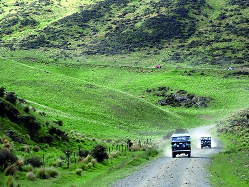
So being on tarseal it was into 2WD as we headed back towards camp. With a right turn off the main road to Motu we headed along Whakarau Road, which soon turned to gravel, and even with the odd rain shower, there was still plenty of dust for the 40 km haul back to base, with km markers all the way, indicating that the road is used by logging trucks,
The valley is large with steep hills on both sides as you climb to a small saddle to cross over into the head waters of Waiwhero Stream, then it’s all downhill again to Motu Road and the very short drive to camp.
And so the first day’s driving was over, 115kms with 90km on track or gravel.
For those that ordered dinner it was served at 6pm under canvas beside the school, and it was not long after the dinner participants returned to their camp sites that the camp grew very quiet with all looking forward to what Sunday was to bring us.
Day 2
The day dawned still very cold with overcast skies, with no set order of departure, just with your group, starting at 8.30 with all away before Tail End Charlie at 10am.
Our route started with a short drive back down Motu Road and onto Whakarau Road into the dust. With intermittent rain showers and dry patches under the trees, it promised to be an interesting day.
Approximately eight km down the road, not long after the first ford of the day, we turned right into the first station of the day. Through a number of gates to arrive at the first climb of the day, it was steep and on the dampish side, so with separation between the trucks, the climb commenced into the clouds.
Not long afterward we were sidling around a face heading for another saddle, which was hard to see as the cloud was right down with some dampness under the tyres on the grass-covered sections of track.
The gates were open for this first stage which made for easy travel, and - again - it was not long before we were sidling around the head waters of Matawai Stream on a slow descent towards State Highway 2.
The group in front is within sight at this point, as all have been slowed down. It’s a dairy farm we are travelling on at this stage and soon enough we’re on a dairy race, with cows in the paddocks alongside. And there is then a short uphill past a station house, and out onto the highway turning left for a short haul to head down Rakauroa Road, back onto gravel.
A short distance down the road we pass a concrete tower which once supported a bridge for the rail line being built through the valley, (which never did get completed) and there’s another example just before you arrive at Motu itself, complete with a history board.
Smart (Rd) move!
It’s a narrow country road with signs indicating logging trucks operating, and still rain drops appear on the windscreen as we climb towards the clouds once again. Hard left onto Smart Road (No Exit) with signs for Burnage Station which was recently purchased by Air New Zealand and planted in pines for carbon credits.
There’s (yet another) interesting sidle around the hill as we climb in cloud and rain to 850m - the track is very much single lane with a dseer fence running along on our right hand side for most of the way, and small pines beyond.
Up in the clouds we stop for morning tea and a short break. Visibility is not that great and it’s a little weird as other trucks come up the track almost appearing from nowhere. As we head downhill, though, it’s out of the clouds and the wipers stop as rain is no longer falling.
The track is interesting and still requires a good deal of concentration as we cover the country side with the odd gate along the way. Once again we reach tarseal and head for Rere Rock Slide, but as we approach the line of trucks parked in the car park and on the side of the road, we decide to continue on to Rere Falls.
Dropping down to the car park it is empty of trucks and only a couple of cars present. Finding a spot to park we have a bite to eat and a walk to the falls. It’s a relaxing time, but again it’s not long before the carpark and parking area above are full of trucks as other groups arrive, enabling us all to catch up with the other groups.
Lunch over, its up the short narrow entrance drive to the main road and a hard left and a right hand turn onto another gravel road leading to our next adventure, past station buildings the road ends and the station roan/track begins.
Big, wide, open country
We stop to engage free wheel hubs and four drive as the track looks to climb ahead. It’s big, wide open country, almost like the South Island, as we climb on a well maintained track up the valley to pass over a saddle then wander along another valley with Paeroa at 431m on our right, the clouds still dark above, but no rain which is great.
The track heads down the valley with a number of concrete fords along the way, no water as the creeks are dry with stock around the water troughs. Over a cattle stop and we are on council roads again, still gravel and predominantly one way, heading back to State Highway 2. At this point the loop is almost complete as it’s onto the tarseal for a few kilometres towards Motu, and a brief rain shower, before we turn right again.
In this case it is into a dairy farm tanker entrance and in the distance I can see the dairy shed we passed in the morning, so back up around the shed, this time turning left once past it to sidle around a ridge slowly climbing along the way.
This tracks a little rougher the further along it we travel, climbing steadily. We have another group in front and as they descend a short step section we stop to admire the views of the surrounding countryside, down the step section, still working our way along the ridge to a high point, parked on top of which is a group of Land Rovers.
Through a gate with a sign advising low ratio, first gear, the map showed a 200 metre face down which we travelled. The first section was very steep and wound its way down and across the face to a gate at about the halfway point. Slow and steady was the order of the day with groups ahead and behind as we all drove this section.
Arriving back on Whakarau Road it was a hard left and maybe 10 km back to camp. I stopped along the way to take some photos before heading to camp. A small delay along the way due to a mob of sheep travelling the road in the same direction, but that is all part of rural New Zealand.
Dinner that night – by the way – was a Hangi with ice cream and chocolate brownie for dessert! At 8pm festivities moved to the school, for a short speech/presentation by event organiser Paul, the drawing of the two raffles, presentation of prizes for the colouring competition and the scavenger hunt, along with all the sponsors giveaways. With a big thank you to all the sponsors and land owners who had given permission for the safari to cross their land.
Paul also advised that Monday’s route was to be made up of four shorter loops, the first being approx one hour 40min, the next two an hour long each and the final one being 40 mins, the idea that at the end of each section you – had the option to return to camp and check out; if for instance you wanted or needed to leave early.
Starry, starry night
The meeting broke up just after 9pm as the sun had set and it was getting dark. But for the first time in three nights the cloud had lifted and you could see stars in the sky along with the moon; a sure sign the weather was on the improve.
Monday then and the activity in camp was one of packing for those who wanted to head home early and be on the tracks early. Same timing out the gate from 8.30am onwards, all ticked out my group now just four trucks was on the move.
Across the Motu River bridge before a hard left then right into the station and the track uphill, just a short section to settle the mind and truck back into the grove, and not long later we are on the Motu Road heading away from the school.
A hard right through a tight gate then up, uphill on long and damp grass, we again went, well defined by the number of trucks ahead. Sidling around under Taumataokaretu, onto the ridge and it was into the bush then all stop!
There’s a very steep downhill section ahead, which requires a bit of separation, and was taking longer than it should have due to lack of communication between groups. As we started down a marshall arrived to assist with moving the vehicles forward, which, from the number of vehicles moving after we got to the bottom, was working.
A couple of small stream crossings later we were heading down stream on the true right, eventually ending up on what is known as Hydro Road, as it was developed in the 1960s as part of the hydro exploration of the Motu River.
At Marumoko Road there was then a left turn to drive through Paparangi Adventures, a high country station offering exclusive use of 800 ha of native forest for recreation, hunting etc from March 01 to November 30.
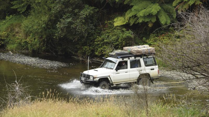
The groups crossed through Paparangi then exited by fording the Motu River, to travel down the Motu Road. Further down the road the first option to depart presented itself as the arrow pointed us left through one gate and almost straight up towards another, which, once opened and reading the sign indicated that it was to be left open and closed by Tail End Charlie on his way through.
Carry on regardless
For those of us keen to continue it was up and down as we climbed alongside a small stream, with one very tight right hand corner before a tight dip in the track and another climb on a fresh cleaned track.
This track had it all, uphill, tight sections, the odd patch of mud which meant being in the water table, you had to stay awake and concentrate all the time as it dipped and wove around the hill sides.
All too soon however, it was yet another road right for camp or left to continue. The group decided to continue and find a place for lunch along the way, a narrow tight entry gate leading us onto the track and uphill again.
A few (more) gates, a couple of very tight corners and a very nice downhill section brought us to a gate beyond which was a creek and then a mound to the left which looked like the place for lunch. So lunch was had some 30m above the track out of the dust with a view up the valley to the ridge line and the steep section we had come down, so – of course - we spent the time watching those behind us coming down the track..
Lunch over and back on track, and we again had the choice of heading for camp or the last loop. But once again we all elected to go on. This time it was onto a dairy support unit, of 350 ha, and as we headed along the access lane way, passing stock on all sides, it was a very pleasant and relaxing way to finish an interesting days’ 4Wheeling.
Thank you and good night!
Finally back at camp it was time to kick back and reflect on the three days gone, the 275 kilometres travelled, of the friends, those met again and those newly made, and the privilege afforded to us by all the land owners who allowed the Motu Safari 2021 to pass over their land,
Finally, a big thank you to all who made the event happen, and to my group for putting up with me stopping all the time to take pictures.
To Paul and Shelly, your team, the guys and girls of the Geyserland 4WD Club thank you and hope to see you all again soon.


