
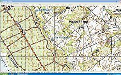
Freshmap is a computer based topographical mapping system of New Zealand. Where it varies from most of its competitors is that, instead of utilising scanned and "seamlessly joined" copies of the existing paper topographical maps, its uses a digital representation of the current data set (vector data). This gives it two significant pluses; the data is more current, as the digital data is updated more often than the printed maps, and it also does not lose resolution as you zoom in. The maps can be printed at up to 1:25,000 resolution. Despite this, the maps will look familiar to those familiar with using the paper maps. There are some minor differences in the colours and symbols but this is only apparent when comparing the two closely, side by side. Freshmap is available either on DVD (one for the whole country) or on CD (7 for all NZ or 4 per Island). Isn’t it great when your laptop has a DVD? Price for a single Island is $165 and for New Zealand $285, which is competitive with other mapping programs. Map zooming and scrolling is smooth and easy to manage and the menus are fairly easy to navigate. No mapping software is yet truly user friendly, as the interfaces on any of the products we have tried are not generally that intuitive. However, Freshmap is as good as, or better, than others we have tried. You can create waypoints, tracks and routes on the map for uploading to a GPS, using a simple drawing interface. You can also download tracks and waypoints from a GPS. The data is stored in a built-in database or it can be exported and saved as an xml file. The use of the internal database is a bit hard to fathom, so I used the ‘export and save as an xml file’ feature, which is similar to that used by other mapping programs. This gives you the flexibility to only load the required tracks; handy if you have multiple track files in the same area. Freshmap has an interface built-in, to link to Garmin GPS’s. There are some gotchas with this though. All current Garmins, with either serial or USB interfaces, are supported and many common older models. My own GPS a Garmin III was not supported but the developer was able to provide an updated protocol file within a few days to suit it once he got hold of the GPS. They will do this for other Garmin GPSs as well, if required. Other units are not currently supported, as Garmins are the most popular in New Zealand, due to inbuilt support for the NZ Map Grid co-ordinate system which is lacking from most other GPSs. Real time GPS tracking is also supported. The maps on the CD range from 1:2 million scale through to the ubiquitous 1:50,000 scale with the addition of 1:20,000 street maps, which are very handy and are a similar scale to a typical City map book. Some other things I liked were that the print routine was very flexible and easy to use with a ‘what you see is what you get’ preview and the ability to update print area and scale from within the preview, the Zoom in and out was fast and the retention of clarity even at high zoom was definitely nice. It provides a nice fresh alternative to current mapping programs. More information at http://www.mapworld.co.nz/freshmap.html . :
A new view of mapping
Monday, 27 February 2006