After initially basing themselves in Westport, David Coxon (and co!) decided to mosey on down to Reefton next. Three days there netted them more stunning scenery, much of it still only practically accessible by 4WD.
This was an easy two-hour drive away, so with no other plans for the day we were able to have a relaxing breakfast while the tents dried out in the morning sun before packing up and heading for Reefton.
Like Westport, the Reefton campsite had no specific sites for unpowered tenting, rather we were told to just grab some space round the edge of the field. With some advice on the sun’s movement from the guy mowing the grass, we ended up with a site getting almost all-day sun and with a large tree next to us offering some welcome cool shade – it was much hotter in Reefton than it had been in Westport.
Despite it being a Sunday, we decided to walk back along the main shopping street in Reefton to get a feel for the place. We were pleasantly surprised to find that many of the galleries and curio shops were open, as was the Visitors’ Centre with its small attached historical museum. These kept us occupied for the afternoon, and a chat with the woman in the Visitor’s Centre gave us all the information we needed to find and tackle the Big River track the next day. We were also given directions to a number of the other historic mining sites in the area, which we hoped to visit, time permitting.
Going back to Big River
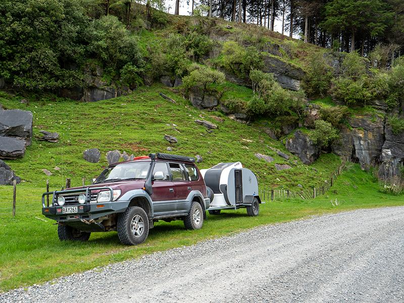
When we got back to the camp, there was a group with 4WD vehicles, mainly Prados like my Prado Purple, setting up camp opposite us on the far side of the field, although we didn’t get a chance to catch up with them.
My understanding from the history of the Big River area that I got from the Visitors’ Centre, was that there were a number of small mining operations in the surrounding hills all extracting gold from the same gold-bearing reef under the ranges. Over time these consolidated into a smaller number of larger industrial-scale mines boring deeper into the reef.
When they were operating, they all had access roads for horse or bullock-drawn drays, but now some of the roads have gone and some have been improved to good gravel roads to provide tourist access to the old settlements. The Big River access road is, however, still at a near-original condition and as such only suitable for 4WDs. This was our planned trip for our second day in Reefton, a trip I had last done about 10 years ago.
A welcome sign
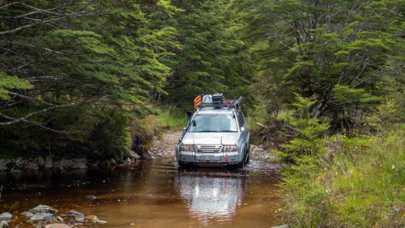
Leaving Reefton, we turned off SH7 up Soldiers Big River Rd, which gave us about 15km of good gravel road before we reached the sign advising that the rest of the track to Big River was unmaintained. Time to air down. The first section was across somewhat soft and muddy terrain that involved a lot more wheel placement and axle-twisting than I remembered, although there was no deep mud, and everything was well within the capability of the vehicle.
Once we started climbing the surface dried out and became a bit smoother, although with some quite sharp ‘in and out’ where little creeks crossed the track, usually on tight corners. As we climbed higher, the vegetation slowly thinned out and we became aware of the drop off one side, often going almost straight down for over 200m.
We stopped a few times to look at some of the small, abandoned shafts going in off the track but there was always the issue of there being very little room to pull over. Luckily, we didn’t meet any other traffic on this part of the trip and eventually reached a larger stream below the relatively flat plateau where the original mine settlement had been.
Looking across the stream, there were two tracks out of the stream and onto the plateau. The challenge was to work out which one, if either, had not been chewed out by hoons with big tyres. Luckily, I picked the right one, and climbed out onto a good, solid track across the plateau.
Disappointingly, the flat areas on either side of the track were a muddy, rutted mess, the sort of behaviour that is already getting roads in the area gated to protect the site. From here the final section to our destination, the winding house, was a climb up from another stream crossing.
Team Prado photo op!
This was a little more challenging, a lot longer than I remembered, and in many places definitely one lane only. As I finally spotted the winding house through the trees, I also saw another 4WD starting down towards me. Luckily, he saw me at the same time and backed up. It would have been very awkward if they had left a minute or two earlier. Arriving at the top we recognised each other as “the other party” from the camp site. This resulted on a good chat and some team Prado photos before they headed off and left us to our lunch.
After a pleasant lunch break outside the winding engine house, we explored the old and largely complete engines, finding that the building housing the engines was a well maintained near-copy of the original building and the poppet head (where the cable dropped down a shaft to the working part of the mine) was still in place, giving a clear picture of what the site would have been like when in use.
The return trip, being mainly downhill, seemed easier that the trip in, but it was still another two hours before we got back to the maintained road. By the time we got back to camp we were glad to rest up after another quite long day of intense driving.
Final day
Our third and final day in Reefton was much more relaxing, with a walk along the partly restored water race for the original Reefton power station and an afternoon visit to Waiuta, and the Blackwater and Prohibition shafts at the end of a good gravel road.
There was lot of good historical information at these sites, although not surprisingly, there was a lot of similarity in the stories of each place. It must have been a tough life! I also found it intriguing that we were about 500m above sea level and the deepest shafts went down to over 100m below sea level – amazing engineering for those days in a newish colony.
Finishing our explore, we made a point of getting back to camp early to prepare ourselves for an early start and long day the next day, getting to Hanmer Springs via St Arnaud and the Rainbow track.


