After a good look at the West Coast regular NZ4WD contributor Gary Cooper now talks us through the rest of his and mate Greg McQuaid’s recent ‘epic FJ adventure’ around the South Island.
Following Topo Maps on my tablet we did several shingle roads heading towards Arthurs Pass and had a short adventure up Maori Gully.
We were now at the top of Lake Brunner where we approached one of the stations about access for a short cut showing on the Topo Map versus a long shingle road drive. After finding the owner he asked how we felt about deep river crossings, which begged the question how deep? The reply came back very quickly and with a smile as “wiper level!”
As we both have modern petrols so weren’t keen on wiper depth at all so the farmer kindly offered to take as to the crossing and showed us the line and assured us the base was solid. I still think he wanted to see if a couple of Jafas would do it; apparently he crosses it every day but now just after heavy rain he did admit it was flowing just a bit faster, though assured us it should be driveable.
Give it some Jandal!
So after some friendly banter about the respective merits of both islands, I was first in and it wasn’t as deep as he suggested but it was wide and about half way across the back end of FJ started drifting to meet the front end due to the force of the current. And in order to make the planned exit point, which still seemed like a long way when I was in the middle of the river, I needed to change course and give it more “Jandal” to keep my bow wave!
Both FJs made the exit point as planned however we are still not sure if the farmer would have crossed himself that day! To his credit he did arrange for two locked gates to be opened for us and had his Station Manager wait for us at the last gate to make sure we got out OK, so asking permission first is worthwhile.
The Great Divide
After crossing Arthur’s Pass, we headed into the Hakatere Conservation Park which is in the Ashburton Lakes area behind Methven and between the Rangitata and Rakaia rivers bound for Lake Clearwater.
The idea here was to stay for a couple of nights to ride out Cyclone Cook and see some Lord of the Rings scenery by driving to Edoras (or rather Mt Sunday) which was where the fortress city of the Rohan people was built for the Peter Jackson movies.
Apparently it took nine months to build the sets (which were unfortunately all removed after filming) but the scenery even in the rain was great.
Apparently, the rain never stops during a cyclone, as we found out ourselves, as we had to dig trenches around the tents to stop small lakes forming in our kitchen area. On the positive side our Foxwing awnings were really earning their keep.
Lake Clearwater has a 4WD Track around it that is managed by the Combined 4WD Clubs. This track gives you access to fish your way around the lake, which we did, albeit unsuccessfully as far as actually catching something was concerned.
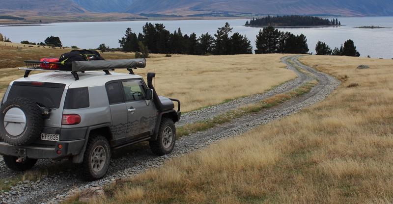
We also drove the 4wd track into Lake Emma before heading south to Lake Tekapo.
An afternoon exploring
We had planned to drive into the Macaulay Hut but due to high river levels and more pending rain we opted to change our itinerary yet again, the sun was shining so we went straight up Lilybank Road which runs up the right side of Lake Tekapo as you look out from the church of the Good Shepherd.
We had hunting permits so where keen to check the area out and popped into the stations along the road to arrange access to different areas where possible and it was, so spent the afternoon in low range exploring the area before finally camping near Twizel at the Lake Poaka Conservation Area.
The next morning, we headed down the Pukaki River which runs from Lake Pukaki to Lake Benmore and into the Haldon Arm Camp. This is a fantastic camping area unique in that it is managed by a trust made up of regular campers but the campsite is open for everyone to use. Most people access it from Burkes Pass, but our route following the river was far more fun and gave several opportunities for play stops.
Our next adventure after arranging permission and paying the fee to receive the locked gate codes was onto the Black Forest Station, which has a very scenic drive down the side of Lake Benmore and drops you out on top of the Benmore Dam. That night we camped at Sailors Cutting on the side of Lake Benmore.
We interrupt this trip….
It was now time to slow down, and stop living out of the FJs so we rented a holiday house at Lake Tekapo for a few nights so we could catch up on washing, dry our gear out and have some R&R. While there we tried unsuccessfully to catch one of the large trout that are apparently everywhere in the canals and are supposedly so easy to catch that even international tourists can snare at least one.
After a few frustrating hours, however, we opted for the very cheap and lovely Sushi sold at the fish farm. I must say, too, that we didn’t leave the South Island High Country completely empty handed, having managed to hunt and shoot two deer on the trip, so at least Venison was on the menu.
While staying in Tekapo we also visited the Mt John Observatory during the day, and as part of their Earth and Sky Tour one evening. This site was selected as the best place in New Zealand for the observatory due to its clear night ratio and remoteness from bright Lights (Note. The street lights in Tekapo must face downwards and be capped to support this dark sky).
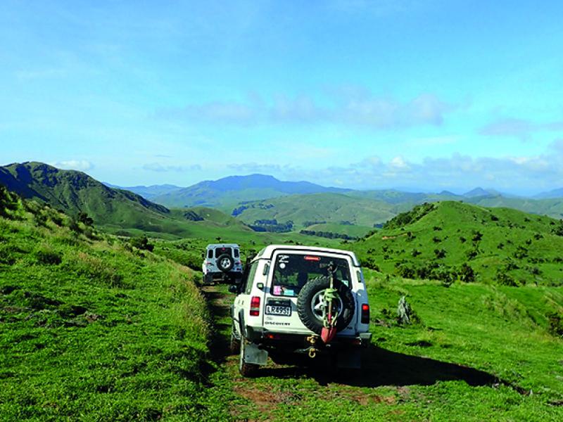
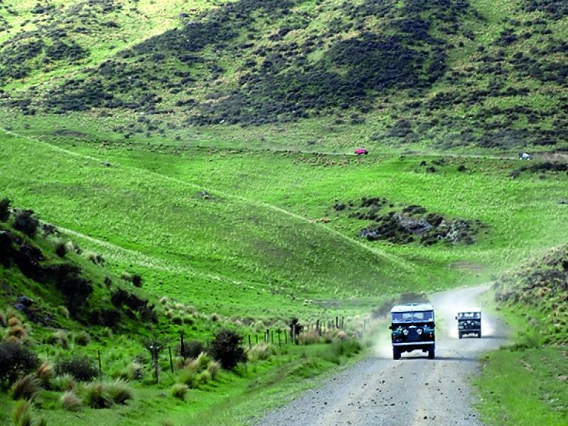
Back to the FJs and driving off-road though. Having Topo Maps running live on the dash meant we could see different tracks or legal roads as we explored. We always asked for permission (even if we thought we didn’t need it) and were nearly always granted it. Often the roads that went through farms weren’t really 4WD tracks but did require a 4WD.
What these roads/tracks did do was provide great high country scenery as we crossed various farms, always being mindful of treading lightly and leaving everything as we found it. One farmer was very direct when we asked and simply said “it’s a legal road you’re welcome, I’m not sure if you will make it through as its over grown but you can try”.
What we didn’t realize, or he failed to mention, was that we ended up crossing into his neighbour’s farm and as we crossed the last stream before the gate onto the shingle road the neighbouring farmer came down to see who was on his property. I wasn’t sure what reception we would get but after explaining I had seen “John” his neighbour first and that we had closed all gates and stayed on the track he was fine (Basically showing him that we were responsible 4WD drivers and not ripping up the place), we had a good chat about the area before moving on.
Time to head for home
It was now time to head north, so we did a quick blast back to Murchison and stayed at the local campground for what we thought would be a restful night. However that evening a large truck ran off the road outside our campground as the driver failed to take the bend after falling asleep at the wheel!
This stretch of road over the Lewis Pass to Picton is not only getting very damaged from the heavy trucks but is very congested which makes some people impatient, to the point where we witnessed more crazy overtaking and reckless driving on this section of road than on the entire trip.
Next stop was Wellington for a night, then the Wairarapa, near Cape Palliser for some 4WDing down Whangaimoana Beach and walking the Putangirua Pinnacles loop track which has some amazing rock formations that (also) were featured in The Lord of the Rings movie: Return of the King.
After two nights enjoying Martinborough and the wineries we pushed north to Napier and did a few of the Hawke’s Bay cycle trails (in particular the ones around the wineries and coastline) for two more nights before finally heading back home.
And so, that’s it from myself and Greg – for the time being anyway. However, as I’m sure you can imagine, we have already started talking about another trip next year, so I have found myself searching the net already looking for new routes and tracks.
Ends
SIDEBAR:
Key Tips.
1. It will take longer than you think, so plan for extra time and be flexible with your itinerary
2. Have electronic Topo Maps on a GPS device (We also had Hema Maps, to show campsites)
3. Having two vehicles meant we could be flexible and move fast
4. Get as much pre-approved/arranged access as possible in advance
To read every story in the December 2017 issue of NZ4WD go to Zinio.com (Nov 17) or purchase your own hard copy at the Adrenalin store.