Last month regular NZ4WD contributor Gary Cooper talked about how to plan a 4WD adventure. And now this month we’re off to the South Island!
At last it was time to load the FJs and head south. Both had been fitted with Foxwing awnings with zip-in side walls to ensure we had plenty of undercover area in case of rain (we hadn’t heard about Cyclone Cook paying us a visit yet). To make the most of our time we decided on an early start so we could drive to Wellington and catch the 5pm sailing across the ditch the same afternoon.
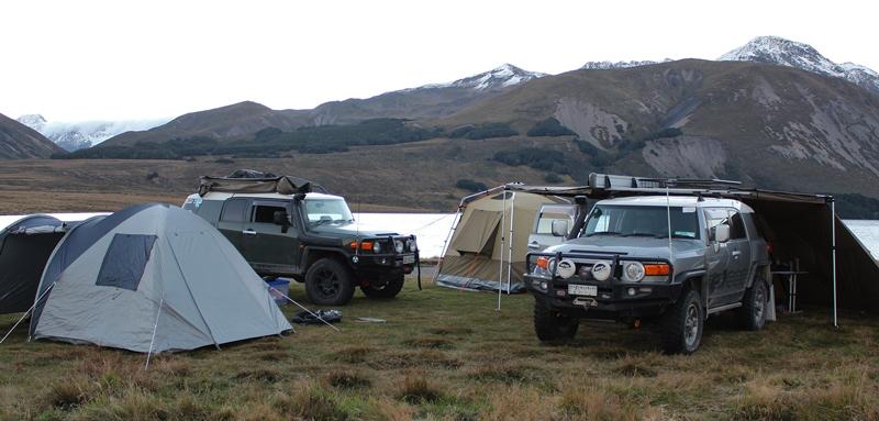
To make the trip to the West Coast more interesting after a supply shop in Picton, we drove through the Molesworth Station and camped at Lake Tennyson next to some crazy bikers who had just driven Honda Cub scooters through Rainbow Station and were heading out the next day via the Molesworth. Those roads would be hard work on small skinny tyres. We were paying little attention to the 1,100m altitude until the next morning when we awoke to a glorious High Country day and frozen drink bottles!
Rainbow Station road was next, of course paying the required $25 access fee. This pops you out close to the southern end of the Nelson Lakes close to St Arnaud or Lake Rotoiti; it’s an easy scenic drive that doesn’t require low range but is much more interesting and enjoyable than the tarmac.
After a quick coffee it was time to head north west towards the Howard Valley and the Porika Track. En route we saw signage to Simons Track so did a quick check of the Topo map loaded on my tablet and decided on the detour; we ended up driving up the river bed crossing the Porika stream several times which delivered the perfect place for lunch.
After lunch, and somewhat too relaxed driving slowly up the river bed, the front of the FJ dropped quickly and started disappearing into deep water and soft shingle (Note: a timely reminder to check every crossing before entering). With a quick flick of the rear locker and hastily changing the transmission to the R position I quickly retreated, not wanting to be the first FJ stuck on the first day. I shouldn’t have worried as Greg in his green FJ managed this task very competently just a couple of hours later by neatly parking in a very soft swamp.
The Porika Track takes you down to Lake Rotoroa. It’s a bit steep and rocky in parts, but nothing challenging. We then did the Braeburn Track from Lake Rotoroa to Murchison. This isn’t a 4WD track but a well-formed shingle road, but did satisfy our quest to try and avoid the tarmac where possible; we ran out of time to start the next track as we had planned, so camped at the Lyell DoC campsite for the night in the Upper Buller Gorge some 35km south of Murchison.
Next, we were tackling what is known as the Iron Bridge to Denniston track (or alternatively the New Creek to Denniston 4WD Track). This drive is fantastic, so after contacting the Westport DoC office to confirm access requirements we were off. This road was built to service the power lines and has a few river crossings; the only one that can be challenging after rain is the Mackley River (otherwise the crossing is just a slow boulder hop across). The road passes through a series of forested hills and valleys as it traverses the Mt William Saddle onto Burnett’s Face before finally arriving at the historic coal mining area of Denniston.
Denniston was one of New Zealand’s most productive coal mines. In 1895 it provided the largest tonnage of coal in the country; however, as part of this achievement they had to solve the challenge of getting all that coal down a very steep slope some 500m below them towards the coast. Good old Kiwi ingenuity resulted in a self-acting incline powered by gravity, basically loaded wagons were sent down the slope balanced against empty wagons that needed to be returned to the top to be filled again. The plateau has very good information panels that explain the life and history of Denniston along with the engineering feats of the incline and the hardships of life during this time.
I must confess that I managed to get FJ stuck whilst enjoying the drive to Denniston (To be honest, somewhere it shouldn’t have been possible if I had been paying more attention to the road versus the scenery) which resulting in me needing to use my winch, unfortunately or luckily depending on how you look at it at the exact same time we bumped into some very friendly members of the Manukau 4WD Club doing a recon for a future club trip, so after some mockery and friendly banter about my ability to park inappropriately, I received some assistance and we were on our way again.
After visiting the sports store in Westport we received a tip about a good 4x4 track and free camping spot so we were off in search of a new adventure, however just as the track started getting gnarly a very large tree had fallen across the track resulting a careful reverse back to a suitable turnaround point, but it was worth the try.
After losing some time we decided a night in a dry and warm Reefton cabin was the best option considering that the forecast was for very heavy rain and we wanted to leave early in the morning so a pub meal accompanied by a beer or three was very enjoyable.
We drive up to the Big River Settlement in the morning. This road twists through one of the most intact mining areas on the west coast past several historic places and mines that can be accessed by short walks such as a restored winding engine shed, a mini poppet-head, the remains of Tin Town, and several mine shafts. The drive is slow, rocky and full of blind bends that require a lot of concentration but very simple 4wd wise. By now the rain from Cyclone Cook had really started to set in so we opted to stay at the Ikamatua Pub as it was close to the start of the next track being Napoleon Hill and the Waipuna Caves which we had already arranged permission to access via private property the next day.
However, our plans changed after speaking to the land owners in the morning who suggested that once we were in the gorge there was a risk of flash flooding due to all the heavy rain and if this happened we would have no exit possibilities. Their advice was to wait it out, this is a good example of why local knowledge can be very important, so after checking the forecast we decided to head south and make this rainy day a productive drive day instead.
Key Tips:
- It will take longer than you think, so plan for extra time and be flexible with your itinerary.
- Have electronic Topo maps on a GPS device (We also had Hema Maps, to show campsites).
- Having two vehicles meant we could be flexible and move fast.
- Get as much pre-approved/arranged access as possible in advance.