From the East Coast to the West, NZ Adventure’s 4WD West Coast Explorer takes you from tussocks to bush-clad mountains and untamed rivers. Story and photo by Kate Taylor.
Rugged mountains, towering cliffs, bush-clad hills and spectacular rivers… always highlights of a West Coast adventure.
When you’re 4WDing off the beaten track you can add hidden tunnels, tortuous tracks and the occasional rusted vehicle down in a gully.
The five-day West Coast Explorer is one of a handful of different South Island trips offered by NZ Adventures’ owned by Robbie and Connie Crickett. The West Coast outlook is dominated by bush and water, while their High Country Heritage Safari is dominated by more barren landscapes. Both feature great views and substantial drops alongside tight tracks. But most of the time the West Coast disguises its steep drops behind the bush.
“If you can see it’s steep in the trees on the uphill side then it’s just as steep on the downhill side even though you can’t see the drop,” says Robbie.
Route to suit
NZ Adventures’ 4WD trips are not the up-down-sideways and mud-splattered variety. The overall plan is to get from Hanmer to Greymouth via Murchison, Westport and Reefton but it’s not a straightforward jaunt on a state highway. Their intended path between destinations is always provisional – they reserve the right to alter the route as required to suit any unplanned weather conditions.
There’s a saying ‘if you can’t see the hills on the West Coast, it’s raining. If you can see the hills, it’s about to rain.’
For the West Coast Explorer trip, waking up to light rain on the second day puts a worried look on Robbie’s face. They do regular checks of the routes but there can still be so many nature-induced changes to tracks in the middle of nowhere.
The beauty of Molesworth
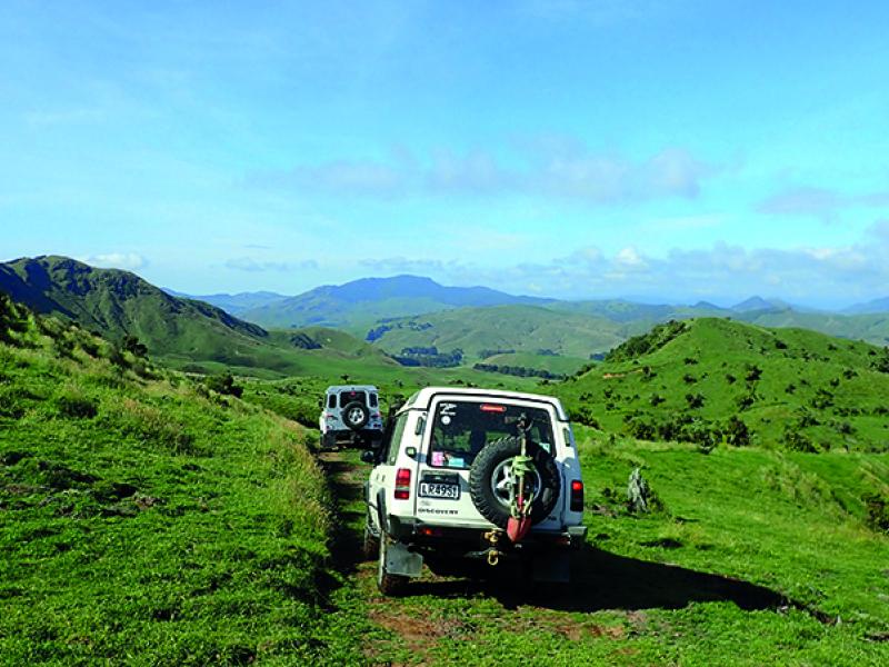
A group of vehicles and drivers from around the country, including one journalist (me!), gather for the first night at Hanmer Springs before traversing the expansive Molesworth and Rainbow Stations to get to the West Coast.
Morning tea and lunch spots are chosen for their beauty – morning tea is in the St James Conservation Area (after a Didymo spray on the wheels at the top of the Maling Pass and with a liberal helping of insect repellent) and lunch at the picturesque Lake Tennyson.
We drive out of the Clarence River’s catchment to Rainbow Station via the Island Saddle. At almost 1400 metres in elevation it is the highest public access road in New Zealand.
The day finishes with a drive over the Porika and Braeburn tracks, which, like the road through Molesworth, were put in for the construction and maintenance of the power pylons so often silhouetted in our view.
Take me to the river
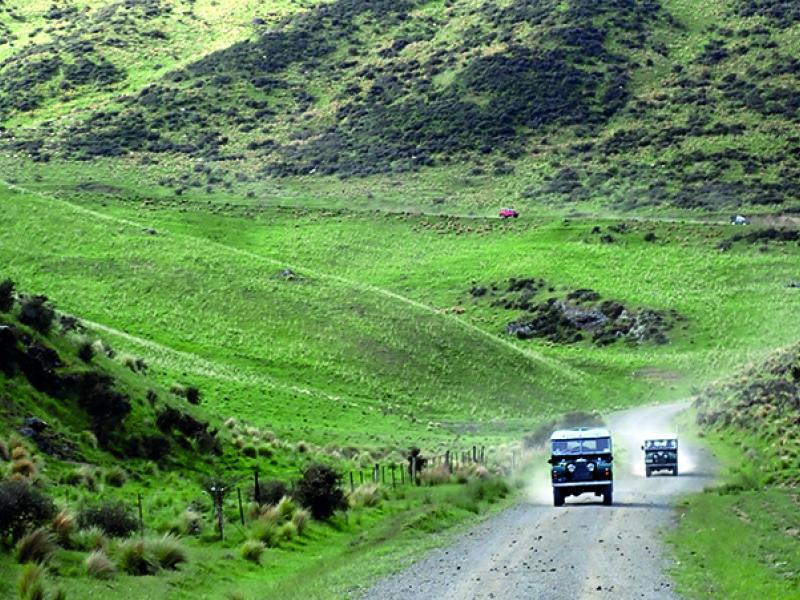
Day Two of the West Coast Explorer is shorter in distance but is a full day of travel mostly in low-range four-wheel-drive. We’re travelling from Murchison (then back) to Murchison via a few river valleys and a couple of mountain saddles.
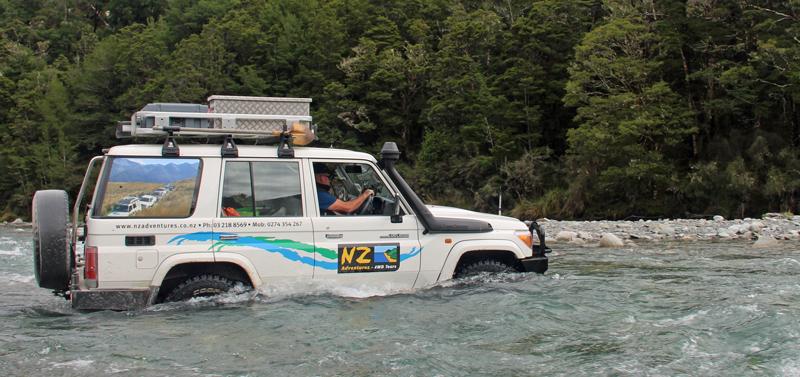
Our first river crossing of the day is the Glenroy River (and the second and the third…)
Robbie reminds the drivers about the dos and don’ts of river crossings that were covered on the opening night briefing at Hanmer.
Robbie says they try to ensure certain levels of 4WD skill and experience when booking people on their tours and they have an idea of what vehicles can hack the conditions.
“Usually we can talk them through situations anyway as everyone is connected through the handheld radios we give them at the start of the trip.”
The second river crossing is deeper and there are a few decent-sized rocks in the best path across so Robbie talks everyone across.
The river flats are extensively farmed but there are also large tracts of beech forest. The progress of the convoy depends on the river levels and the degree of flood debris on the valley floor.
After making our way up the wide Glenroy River valley, we turn and braid our way back. This time we turn up the Maruia Saddle road. The dirt track is a bit tight and tortuous at times but winds up and over the saddle through several stream crossings and down to Frog Flat on Highway 65.
West Coast history
Following ridge systems and diving in and out of valleys is the theme of the West Coast Explorer’s third day. We turn west before Inangahua to follow the pylon track to where we meet the Mackley River. It looks innocuous enough but the water-swept edges and tumble-cleaned logs are evidence of times when the river wasn’t quite so tame.
There’s a working bee at one tributary to remove some of the rocks then another burst on the radios to manoeuvre utes through the stream and across the Mackley.
Next stop Denniston – a small settlement at 600m on the Rochfort Plateau – home to the Denniston Incline, widely regarded when it was in operation as one of the eight engineering marvels of the world.
From coal to gold
We do a 30km snaking journey through the bush into the Big River goldfields and back out again. The Big River mine operated from 1882 to 1942 and it was lack of skilled workers that closed it rather than the lack of recoverable gold.
Fresh scones are waiting for us at the Ahaura home of the Smith family. They’re hoping to start a little eco-tourism business alongside their small farming operation. Their self-built house is off-the-grid thanks to a water wheel they’ve also built themselves. The surprising features of the property are also manmade, but a lot older, including a 100m tunnel that might have once been a gold mine and an old sluicing channel or drop chute now known as “the cathedral”.
We travel further up the valley into the DOC Reserve area of Napoleon Hill where nature has all but reclaimed all sign of human habitation bar the remains of one cemetery.
We then start our descent into Noble’s Creek.
“This is arguably one of the finest 4x4 tracks in New Zealand,” says Robbie.
“We wouldn’t be able to use this route at all if it was wet or the rivers were up and we definitely couldn’t use it in the opposite direction. It’s a steep crawl down to the creek bed – it would be a worse crawl going back up.”
Connie agrees.
“It’s different every time we come down so we never know what we’re going to find.”
Now comes one of the highlights of the West Coast Explorer. Early miners diverted the original creek through large tunnels so they could mine the creek floor for gold and we get to drive through two of them.
Later in the day we apparently drive past the normally-picturesque Lake Brunner, but with perfect timing as we near the end of our five-day excursion, it’s raining on the West Coast.
To read every story in the September 2017 issue of NZ4WD go to Zinio.com (August 18) or purchase your own hard copy at the Adrenalin store.