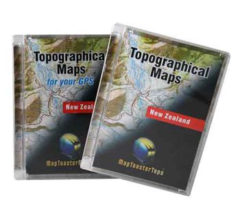
Mapping is something that is constantly updated, anyone owning a street mapping GPS will know this – especially if they live around Auckland where new roads and motorways spring up on a regular basis. Off road you would think doesn’t change as much, after all there are no new roads. Whilst that is true LINZ (Land Information NZ) who do the mapping do constantly review and update the Topographical maps that the computer mapping software and handheld GPS maps are based on, for instance streams move their course, fences are built and new tracks get put in which means it is worth updating.
MapToaster Topographical maps V5.6 (For PC)
In NZ4WD July last year we reported on MapToaster V5.5 which had some significant map updates with 98 of the underlying Topo map sheets being updated since V5, now V5.6 has a further 44 Topo50 updated maps included (if you still have V5 then there are over 140 updated maps now included). Another new feature is that the search facility now includes end-points for the DOC tracks and walkways, making tracks easy to find.
MapToaster Mobile NZ V2 (For GPS)
MapToaster mobile is based on the 1:50,000 map series but with some detail reduced to keep the file size down so the maps can be used in a range of Garmin Mapping GPS units including 60CSx and 62s, eTrex, Oregon, Dakota, Colorado and Nuvi mapping series. In most cases this is via a convenient supplied 2GB Micro SD card that holds the full NZ maps but older units which don’t take a micro SD card can download the maps to internal memory, although depending on capacity you might not be able to have all of NZ in the unit at one time (but you can download the area you need at anytime). MapToaster Mobile includes travel related POI’s (Points of Interest) such as DOC tracks and huts, food, fuel and accommodation, plus National park and conservation land boundaries. V2 updates to all the latest LINZ maps.
Which product do I need
Whilst the two products are based on the same underlying map data they serve quite different purposes. Map Toaster for PC is a computer/laptop based map package, it would mainly be used to pre plan trips and to download recorded tracks and waypoints from a GPS after a trip so you can see exactly where you have been, you can also print out map sections on a colour printer to carry with you and then manually plot your position on this from GPS co-ordinates. NZ4WD uses MapToaster as its preferred software for this application (you can also then upload these tracks back to the GPS if you go back to the same area to find your way). It is possible to connect a GPS to your laptop and show a live track while you are driving but the hassle of securing the laptop (and powering it) means this is something very few people would feel a need to do.
Most handheld GPS units only come standard with basic mapping showing main roads and features, MapToaster mobile lets you add detailed Topographical maps to your GPS to take with you on a trip, this is a great aid to finding your way around as a lot of tracks plus physical features such as streams, contour lines, fences etc are shown helping you be confident about where you are and saving the need to carry paper maps (or print outs from MapToaster ) and hand plotting your map position from the GPS. We wouldn’t travel off road far without Topo maps loaded on our GPS as they have helped us numerous times. To make the decision easier MapToaster have some great bundle deals for the PC and GPS maps.
Why MapToaster
MapToaster is made by Christchurch based Integrated Mapping – a local product with local service and from our experience great support. NZ4WD has been a long term fan of the product especially due to its ease of use, it is intuitive to use and contains a good range of features without resorting to complicated and unnecessary frilly bits which in reality are little used – like a 4WD it’s a good honest hard working product. On the Hi Res version you get aerial and satellite photos as well which help with locating tracks. The MapToaster website (www.maptoaster.com) has a wealth of GPS and map related information including GPS reviews, and explanation of mapping terms and usage .
Pricing – Maps for PC $149 for Std resolution and $249 for Hi res with aerial photos, bundled with MapToaster Mobile $219 for Std resolution and $299 for Hi Res . For upgrade pricing from previous versions contact MapToaster


