This new safari in a hidden part of Waikato offers some memorable driving, history and scenery, all in aid of the local school. Private access to thousands of hectares is no bad thing…
Glen Massey is a hidden Waikato area only 10km from Ngaruawahia that you normally wouldn’t think of as a destination for a 4WD safari, but like many of our country towns it is steeped in history and natural beauty.
Originally known as Te Akatea by Maori it was settled by Europeans in the late 1800s, with farm blocks ranging from 100 acres to several thousand. When coal was discovered there in 1908 the area moved ahead quickly, and by 1912 the Waipa Collieries Company was formed and Te Akatea was renamed Glen Massey. ‘Glen’ is the Scottish word for valley, typically one that is long and deep or with a water course running through it, and as many of the miners were Scottish the name stuck; Massey was for the prime minister, the Right Honourable William Ferguson Massey.
Coal was transported from the mines by rail to Ngaruawahia, and there is evidence of the old train line as the road follows it alongside the stream. You can walk a section of this old line as part of the Hakarimata Rail Trail in Hakarimata Scenic Reserve. There are even the remains of an old coal train that derailed in the creek killing the driver on 28 March 1833.
Coal was also the reason for the decline in the township when the mines closed in 1958, and with that the miners moved away. Once again the village is growing; new subdivisions are on the market as people look for a life in a quiet rural community close to a main centre.
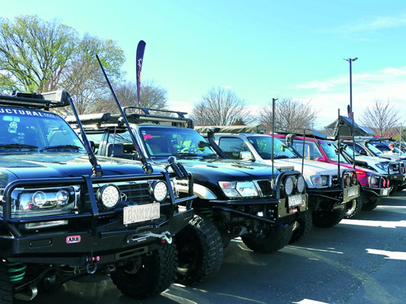
Organised by locals and the Hamilton-based Cozzie Four Wheelers Club, the day safari would raise $3,500 for the local Glen Massey School from the 50-odd vehicles that attended.
The day started with completion of registration and scrutineering at the school followed by a welcome by the principal, Tim Howard, and some of the school children, and then the briefing of the day’s activities. We would travel through several properties in the morning and then return to the school for lunch and the drawing of quite a few spot prizes and several draws of the raffle.
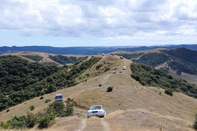
After early morning fog for the drive down it was clearing into a nice sunny day as we headed out in convoy led by members of the Cozzie Club; other members were scattered among the participants in case assistance was needed.
For the morning section we had four neighbouring properties totalling 1,146ha to traverse, which included the first of several ‘little’ challenges. If you didn’t like the challenge there was always a simple and easier B option. The first one was up a steep hill into the trees with a couple of undulating knobs, which saw a couple of vehicles lift wheels if the incorrect line was taken.
On the Bull family farm there are the remains of a former Maori Pa site on the skyline and there are prominent sandstone bluffs on the southern boundary of the property. These are geologically known as Glen Massey Sandstone.
It was then over the road to Gerald and Claire Bull’s 400ha farm, which encompasses three of the original Te Akatea settlement properties: the Rutter farm, the Foster farm and the Runciman property. On the Foster block there is a high limestone outcrop known as Spion Kop, so named by the Fosters probably due to their military connections. Spion Kop was a famous battle in South Africa where the Boers fought the English, and there was a plateau on top of a hill similar to this local landmark. We got to drive up to the top for panoramic views of Western Waikato including Huntly power station, Te Rapa dairy factory and the Raglan windmills.
Back at the school we collected our lunch packs kindly sponsored by Super Value in Ngaruawahia and there was a sausage sizzle underway as well. There were the draws for spot prizes from the many sponsors, which included Stoney Creek clothing.
The afternoon’s drive would encompass another four properties, totalling a further 4,558ha without crossing a road; we started on the 1,800ha Te Akatea Station on terrain ranging from easy to steep contour. Four hundred hectares have here been fenced off for regenerating native bush. After a dusty 15km trek through the length of Te Akatea Station climbing some steep ridge lines we reached the 1,417ha Te Whare Farms and had clear views of Raglan Harbour and coast line and the windmill farm.
Te Whare Farms was the site of the Wilton Collieries Coal Mine and its remains could be seen as we drove along the ridge and hill above. Coal would have been taken out by tram lines down the valley but only the entrance is visible now.
We then entered the Ngaruawahia Forestry, a private block of 1,048ha that has been harvested and replanted between 2001 and 2007. It was certainly a little cooler driving through the forest with the trees providing some shade.
The final property of the day was Kings Ridge, a 293ha farm owned by the King family. For me this was the best drive of the day, with some muddy tracks in the very pleasant bush setting. The property originally had a railway viaduct running through it during the peak of the coal mining but it has since long gone. At the end there was even a compressor at the shed to pump up tyres, and as we exited the gate there was a large sign that said: “Glen Massey Students say Thanks 4 coming” – a nice finishing touch.
There were some other neat features for this first time safari as well: each participant was given a booklet with information about the school, local history and a list of the event’s sponsors and supporters, but particular attention had been paid to the details of all the farm properties we were accessing. It was attention to the little things that made the day a standout, along with the hot, sunny weather.
It was a good day’s outing and one I am sure will be repeated again. By the end of the day we had traversed some 5,704ha of farm, bush and forestry. Special thanks must go to all the property owners for allowing such privileged access and to the organisers for their hard work in putting it all together.


