This month David Coxon had some adventures exploring a few of the higher roads in the Manawatu.
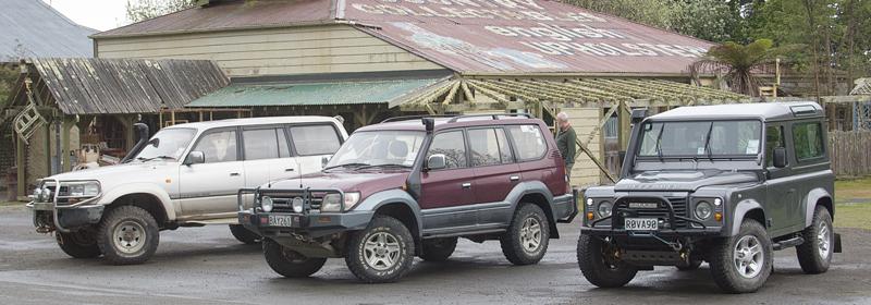
The trip started when May and I met up with a few members of my 4WD club at Aokautere on SH57. We had time to greet the local goat and for May to do a bit of shopping at the curio shop before everyone arrived and it was time to head off.
Our first real track was to be Takapari Rd, which climbs up to the ridgeline of the Ruahine Ranges from the eastern side of the Pohangina Valley. Since the drizzly and murky weather was forecast to improve during the day, we decided to take the long way by heading all the way up the western side of the valley then back down the eastern side to Takapari Rd.
With a number of keen photographers in the party, frequent stops were the order of the day as we slowly made our way up the valley, climbing a little way into the hills on a very muddy unsealed road before re-joining the sealed Pohangina Valley East Rd and dropping back down into the upper valley.
Crossing the Pohangina River we climbed up onto a raised river flat and the start of Takapari Rd.
We paused here to air down a bit and take time for a quick coffee and chat out of the wind. It was quite pleasant although still threatening rain, so we were soon on the move again on the climb to the ridgeline.
Conditions changed
We managed to get some nice although overcast views down the valley during the first part of the climb on a good if narrow road through farmland but once through the last gate and into the Ruahine Forest Park both the track and the conditions changed.
The track was quite a bit steeper and rougher, although nothing beyond the capability of a high clearance AWD SUV, and views became a thing of the past as we reached the clouds. At first we were traveling through stunted trees that loomed up out of the mist, a sight that could have come out of any Lord of the Rings movie, but as we got higher the trees gave way to tough sub-alpine bushes that were often barely visible at the edge of the track.
By the time we reached the ridgeline the temperature had dropped to single figures with a strong wind and rain. Visibility was also often only a matter of metres beyond the bumper and I was pleased that I knew the area and that there were no side roads to cope with.
Foresight rewarded
As we progressed I was also glad that I had had the foresight to mark the hut location on the GPS on my last trip since it would have been easy to miss it in the mist. We stopped at the hut, which as usual was a bleak, barren shell compared to the warmth of heated cars, but would still be very welcoming to anyone reach it on foot.
The cold weather and lack of any view except the inside of a cloud meant that we were soon feeling our way slowly back down on an uneventful run to where we started.
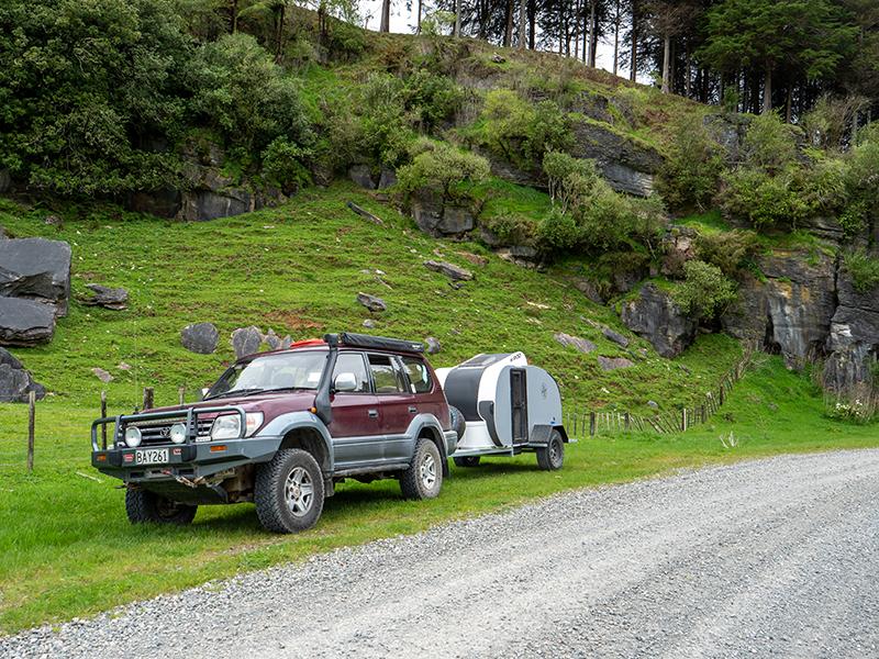
I had noticed an access track down to the river where we crossed the Pohangina River so we decided to make that our lunch stop. The track led to a DoC camping ground that was very muddy but there was also a small grassy area right on the river bank that made a perfect lunch spot.
With an amazing contrast of being about ten degrees warmer, dry and with no wind we had a pleasant and social lunch break before returning to Ashhurst via the eastern side of the valley.
North Range Road
After a quick retail break we used the Saddle Road to cross to the Wairarapa side to access our second track – North Range Road.
The gravel road up to the wind turbine viewing point was in good condition and even in the misty conditions we were starting to encounter some turbines were visible. As we started on the run along North Range Road, however, the clouds lowered and we had the weird view of topless turbines – the base was visible below the mist but the blades were hidden.
As we progressed along the wide power company roads the clouds really started to close in to the point where I was seeing locked gates appear out of the mist because I had missed a turn off. Eventually we found the start of the unmaintained central part of the road in very poor visibility and with the wind and rain returning in force.
Better safe etc.
Clearing an initial boggy section, we continued for about a kilometre on a solid but very narrow and wet track before coming to a deep looking bog hole with a very narrow track along the side. I was not expecting serious challenges this soon, and with the track along the side being on the edge of a very steep and high drop-off I made the decision to call it quits before something went seriously wrong in the deteriorating conditions.
It took everyone a seven-point turn, but we got the convoy turned around safely and retraced our route, breathing a sigh of relief on finally descending out of the mist and back to the main road for the run back to Wellington.
We may not have done everything we planned but as far as I am concerned it was a great adventure, and we made the right decision at the right time to turn back. What a way to end a weekend.
To read every story in the December 2017 issue of NZ4WD go to Zinio.com (Nov 17) or purchase your own hard copy at the Adrenalin store.


